In an information overload age, how do you find reliable sources to navigate unfamiliar waters? Pilot book author, Sean Glynn, advises

When a Volvo Ocean Race yacht famously hit a charted reef at full speed, it wasn’t because the data was wrong. It was because too much trust was placed in it. More than a decade on, in an era of charts, apps and crowd-sourced tips, the real skill lies not in collecting information, but in knowing what to use confidently and how to verify it.
On a moonlit night in November 2014, the VO65 Team Vestas Wind was racing through the Indian Ocean at over 15 knots. The navigator had plotted a course across what appeared to be a 40m seamount. In reality, it was the Cargados Carajos Shoals, a dangerous reef system clearly marked on the chart, but invisible at the scale displayed on the plotter. The yacht grounded hard.
The official report didn’t blame faulty electronics or missing data, the reef was exactly where it should have been. The problem was overconfidence in the information being displayed, and a failure to cross-check against other data available, such as the depth sounder.
The inquiry into the incident concluded: “This incident illustrates that the precision of modern navigation systems can create a false sense of security, leading to a loss of the traditional caution applied when uncertainty is recognised.”
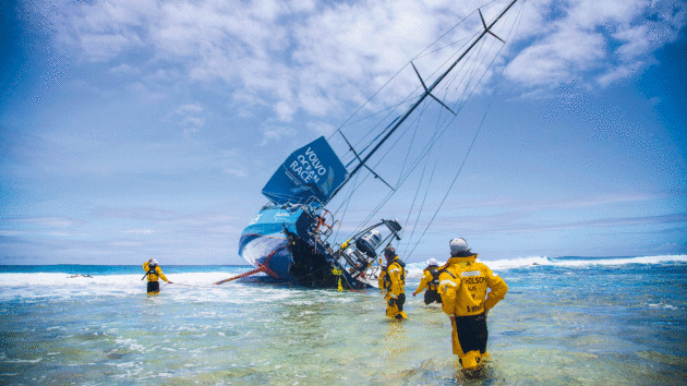
Relying on the wrong chart zoom level led Team Vestas Wind onto a reef in the Indian Ocean. Photo: Brian Carlin/Team Vestas Wind/Volvo Ocean Race
The benefits of doubt
Not so long ago, seafarers accepted a degree of uncertainty as part of the art of navigating. A cocked hat and a cautious assumption that our position lay at the point nearest to danger was considered good seamanship.
Today the risks are different: information has never been more abundant. A swipe of the chartplotter or a tap on a tablet delivers a torrent of charts, apps, reviews, satellite images and crowd-sourced tips – all promising total certainty.
But misplaced confidence now lies in wait for the unwary in almost every modern cockpit. Vector charts, unless viewed at just the right zoom level, can miss critical detail. Data that isn’t updated can be as misleading as a faded paper chart. Online reviews are subjective, and even the most advanced electronics can (and do) fail.
Different information sources update at different rates. Photo: Sean Glynn
When writing Mediterranean Spain for the Royal Cruising Club Pilotage Foundation (RCCPF), we encountered this challenge constantly. The Foundation’s goal – “to support the gathering and dissemination of accurate pilotage information for the benefit of all yachtsmen” – demands rigorous cross-checking. The lesson is clear: in an age of information overload, verification matters more than ever.
Reliable sources to navigate: Role of the Pilot Book
Before the first waypoint is dropped or an anchorage reviewed online, the pilot book remains the most reliable foundation for any passage plan. Written and edited by experienced sailors, backed by professional research and cross-checking, pilot books provide a fixed, verifiable snapshot in time. Even if slightly out of date, they give you a known reference point; a baseline against which everything else can be measured.
Almanacs play a complementary role, supplying essential data such as tides, lights, radio channels and port information in a structured, dependable format. Together, these two sources form the bedrock of traditional planning.
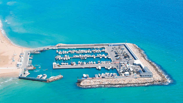
A new breakwater on the north-east side of Puerto Coma Ruga has replaced the entrance but not all charts and apps show it. Photo: Sean Glynn
Paper vs electronic
Charts, whether paper or electronic, build on this foundation. Charts are where planning meets the real world. They give us spatial awareness and context. They bring shape to coastlines, depths to seas. But while charts may look authoritative, they are not infallible and how we use them matters as much as the information they contain.
The first things I look at now aren’t the pretty colours and compass rose that first fascinated me as a child, but the date and datum, followed by corrections. Paper charts age; electronic charts need regular updates and careful handling. Both have their strengths and weaknesses, which is why using more than one source often reveals the gaps.
Paper charts provide a tangible, fixed reference. They don’t crash, glitch or run out of battery, and they give a reassuring overview of the wider picture. They also age. Survey data may be decades old, and without regular corrections they can quietly drift out of date.
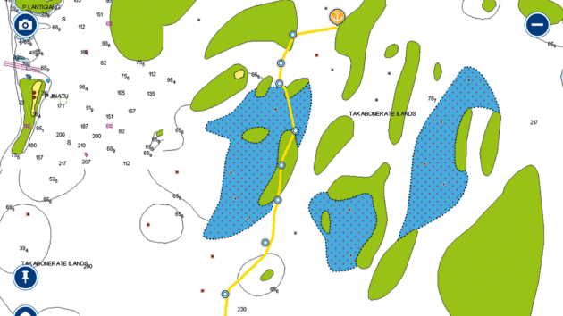
James Frederick uses OpenCPN to create satellite overview charts, but it only runs on a laptop so is not reliable in the cockpit in poor weather. Image: James Frederick
Electronic charts offer incredible convenience and detail, often integrating tidal data, AIS, radar overlays and satellite imagery. But they too rely on underlying data, and their zoom-dependent display can conceal as much as it reveals. Important features may disappear at broader scales, leading to a dangerous illusion of empty water where hazards exist. Updates are not always automatic, and coverage varies between providers.
The most effective navigation combines both. Paper provides the big-picture context and a reliable back-up; electronics bring precision and efficiency. Switching between different electronic chart types, or pairing digital with paper, is often the quickest way to spot inconsistencies. When two sources don’t agree, that’s a red flag — and a cue to dig deeper.
Article continues below…
[collection}
Online tools
Digital tools have transformed the way we plan and share information – from apps and websites to Facebook groups.
A quick glance at an app can often tell you what the pilot book can’t: who’s anchored in the bay today, how much swell there was last night, or whether the town quay currently has working shore power.
Platforms such as Captain’s Mate, Navily, Harbourguide, NoForeignLand, SeaPeople and even Google Maps offer real-time experiences that are invaluable when used well. They can give you a quick, at-a-glance sense of an anchorage, often with recent photos, tips and first-hand reports.
But these tools also reflect their contributors: subjective, sometimes contradictory, and occasionally just wrong. One skipper’s ‘great night’s sleep’ might be another’s ‘night from hell’.
A good example is Soller, in Majorca. One review enthused about a perfectly calm night; another warned of ‘really bad swell kept us up all night’ and recommended dropping a kedge to keep the bows into the swell. Both were true, however, one came from a catamaran and the other from an experienced monohull sailor. Same anchorage, same night, different experiences.
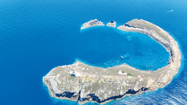
Using a drone to assess the channel into the Mar Menor before entry gave a clear picture of the crunch points. Photo: Sean Glynn
The key is to treat crowd-sourced information critically. Look for patterns and consistency across multiple entries and platforms. If three skippers independently mention surge from easterlies, it’s probably worth paying attention. If a single comment stands out as extreme, dig deeper.
Apps and online platforms are at their best when used to enhance, not replace, traditional sources. They can confirm details, highlight recent changes, or alert you to seasonal quirks, but they need to be filtered with care.
Soft intelligence
Not every piece of valuable navigational information comes written down. Some of the best insights arrive over a pontoon chat, in the cockpit of a neighbouring boat, or from a quick word with a fisherman hauling his nets. This kind of informal, person-to-person knowledge, remains one of the most reliable navigation tools you’ll ever have.
When in Alghero, Sardinia, we received a message from an Australian skipper who was cruising the Med with his family. He wanted to know whether there was room on the town quay and what the protocol was for berthing.
Reaching out like this, cruiser to cruiser, is a simple but powerful way to verify information. A brief conversation might warn you about shifting shoals, or highlight quirks that don’t appear in any pilot book. It’s quick, often more current than any digital source, and grounded in practical experience.
We also make a point of keeping our own notes. Anything that might be useful on a return visit goes into the logbook, from quirks of mooring arrangements to the best time to enter a tricky channel. Not only does it make the log more interesting to read later, it turns it into a personalised pilot book.
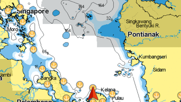
Frederick’s view of his position with Navionics access removed. Photo: James Frederick
Trust but verify
Today’s abundance of data can be as much a hazard as a help if it isn’t handled critically. The precision of modern technology can create a seductive sense of certainty. Charts look flawless, apps are slick, satellite images are sharp. But none of it matters if the information isn’t verified.
Information abundance does not automatically make the modern sailor safer. It can, in fact, lead to dangerous complacency if each layer of data is accepted at face value. Verification is what turns information into knowledge. That means cross-checking between sources, understanding their limitations, and using traditional skills – eyes, ears, soundings and judgement – as the final arbiter.
Whether you’re picking your way into a tricky anchorage or planning an offshore passage, the principles are the same: start with reliable foundations, layer your information carefully, and treat anything that seems too easy with healthy suspicion.
Technology has transformed navigation for the better, but it hasn’t replaced seamanship. Trust the tools, yes. But verify them – always.
When charts turn off
Solo sailor James Frederick was cruising in Indonesia when he lost access to his digital charts.
“In July of 2025 Garmin removed the ability to access all charts for south-east Asia. Every sea chart from Australia to Madagascar to India was removed. I discovered this while being anchored in the coral rich waters of Indonesia, off the island of Belitung,” he explains.

Solo sailor James Frederick was cruising in Indonesia when he lost access to his digital charts. Photo: James Frederick
Frederick, who has a popular YouTube channel (@SailorJames), posted a video on what had happened and received an email from Garmin in response explaining that the Indonesian government had changed their terms for the use of the charts and hence Garmin had stopped allowing new subscriptions or renewals. But Frederick discovered that pre-existing charts were also greyed out and couldn’t be viewed.
“Not only was it impossible to renew my subscription, but access had also been removed to all of the charts I had already downloaded to my device – the very charts I had paid for,” he recalls.
Workaround
“I have sailed more than 18,000 miles since leaving Los Angeles in 2021 and have used Navionics on an iPad as my primary navigation. I never installed a built-in chart plotter because I prefer to keep my boat simple, and expensive chart plotters start becoming out of date the moment they are installed.
“I also have OpenCPN installed on my laptop which I use to create satellite overlay charts for atolls and lagoons that have unreliable or unavailable digital charts. For ocean passages I keep small-scale paper charts on board, but for a cruising ground like Indonesia, paper charts which haven’t been updated in decades –or possibly centuries – can be more dangerous than useful for near shore navigation.
“I found myself surrounded by dangers in remote Indonesia with no easy way to navigate the remaining 700 miles to the Malacca Strait and on to Langkawi, Malaysia.
“Luckily, I discovered that if I put my phone on Airplane mode, all of my downloaded charts reappeared. I quickly turned on the iPad and removed it from wifi access so the charts would be preserved. This allowed me to make it all the way to Langkawi, Malaysia, safely using Navionics on my iPad.”
Reflecting on what might have helped in such an unforeseen scenario, he adds: “An outdated chartplotter whose charts are on a chip would be a great option for a backup. OpenCPN does not make sense for primary navigation for me because the program only runs reliably on a laptop and the cockpit in a squall is no place for a laptop.”
 If you enjoyed this….
Yachting World is the world’s leading magazine for bluewater cruisers and offshore sailors. Every month we have inspirational adventures and practical features to help you realise your sailing dreams.Build your knowledge with a subscription delivered to your door. See our latest offers and save at least 30% off the cover price.
Note: We may earn a commission when you buy through links on our site, at no extra cost to you. This doesn’t affect our editorial independence.
The post Finding reliable sources to navigate – ‘Are there bargains in a ‘buyers’ market?’ appeared first on Yachting World.