Professional skipper Will Harris explains to Andy Rice how to make a navigation plan using weather models to win a sailing race

When he’s working up a weather and routing plan for an offshore race, Will Harris likes to build up the information in layers. The work can start weeks in advance for a big race like the Rolex Fastnet Race, but the homework really starts ramping up in the final seven days.
“From one week out we’re looking at the big picture, how the jet stream is moving, how the synoptic charts are shaping up.
“I’m not talking to the rest of the crew at this stage, I don’t want to bother them with a plan that’s got a high chance of changing in the coming days. But I’ll look to get them all involved in the final stages when things are starting to look more certain,” he explains.
The depth of Will’s research is too great to cover in full detail here, but his five tips should help set you up with a good understanding of how to put your own weather and routing plan in place.
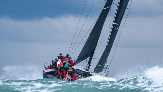
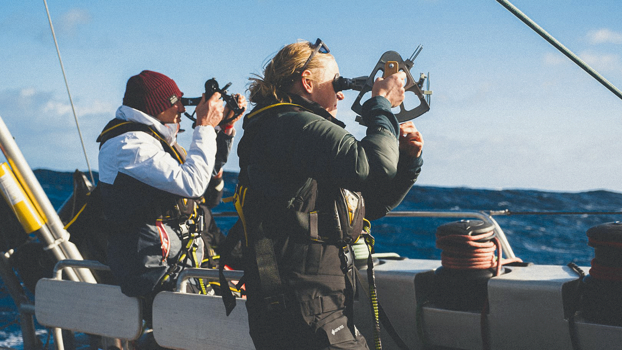
Thorough preparation makes navigating from the rail smoother. Here Callisto heads offshore in the 2025 RORC Admiral’s Cup. Photo: Rick Tomlinson/RORC
1. Making a navigation plan: Get the big picture
Studying synoptic charts will help you understand the big picture. If we’re doing a race around the English Channel, we’re in an area of a few hundred miles radius. We need to understand what are the features on a bigger scale, what are the main features influencing us? Is there high pressure over Europe? Is there a low pressure system coming in?
It’s important to understand the bigger picture before we dig into a smaller, more detailed area, because if we don’t understand the bigger picture we don’t understand the dynamics or the factors that might be changing as we’re racing.
For example, if we’re in a high pressure system, we know that can mean you’re more likely to see night breezes as the sun’s going down, or thermal breezes. Whereas if we’re in low pressure situations it’s much less likely for that to happen, and we’re relying more on the gradient breeze.
2. Analyse multiple weather models
It’s too easy to rely on the routing and not do the more in-depth research. A good navigator will never put their trust in just one weather model.
We’ve already talked about looking at the synoptic charts for the bigger picture, and the next level down is to look at the ensemble models.
You should examine at least four or five models to see if they all align. Have they been aligning for the last few days, or do they show big differences? If they’re diverging, what day do the models start showing differences – day three or day five, for example? Then you know until what day you need to start working on your strategy again.
The more the models start to align, the more confidence we can take from the forecast. For the biggest picture overview the key sources are the UK Met Office synoptic charts; the US-based NOAA (National Oceanic and Atmospheric Administration), which produces the GFS model; the DWD (Deutscher Wetterdienst) in Germany, which produces the new ICON model; and Meteo France, which produces good high- and low-resolution models.
It’s important to look at all four of these models, and there’s a good website for quickly flicking between these sources – wetterzentrale.de enables you to compare the models and see the differences quite clearly.
Article continues below…
How to navigate unfamiliar waters: a pilot book writer shares key skills
When a Volvo Ocean Race yacht famously hit a charted reef at full speed, it wasn’t because the data was…
Using Celestial Navigation to Sail the Atlantic: ‘We are at the whims of the sea’s invisible forces’
One foot east, one foot west. I stand on a line inscribed in stone: the Prime Meridian, longitude of zero.…
3. Get a taste for spaghetti charts
Spaghetti charts are really useful for drawing the synoptic charts in a very basic format, looking at up to 30 ensemble models at a time. Each of the weather forecasts or producers already mentioned will create 30 ensembles and from that they develop one model, the deterministic model, which is the one we get when we open up any weather website.
When you see the 30 charts presented together in a spaghetti chart, it really helps you to see when certain big weather features are starting to diverge. So maybe between day one and four, you’ll see that the spaghetti charts will draw the same circles over the same low pressure over the top of each other.
And then maybe you get to day six or day five-and-a-half, and suddenly you see the position of the low, where the spaghetti lines will squiggle over the whole of Western Europe. This is where the forecast suddenly becomes a lot less certain. The spaghetti charts are really useful for highlighting a convergence or divergence of the different models.
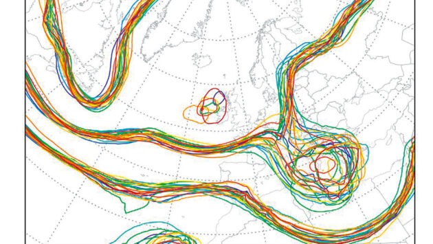
Spaghetti chart helps see where weather forecast models are diverging. Photo: Will Harris
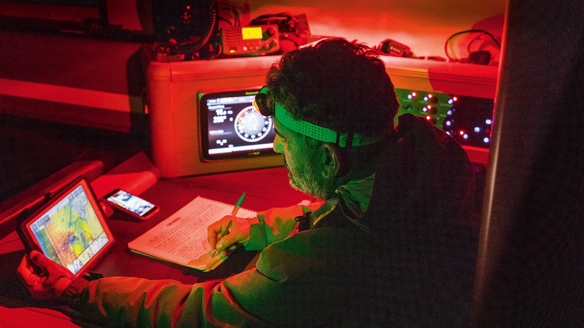
4. Dig into the detail
The website Windy is really the Mecca of understanding the weather and getting a really nice, clean picture at a more detailed level. Windy enables you to overlay the pressure and a hundred different variables.
So, for example, with a weather front you can look at the air temperature at different altitudes. This will help you pinpoint exactly where the warm front is or the cold front is because you can see those changes in detail.
You can overlay the wind and you’ll start to see how the wind is likely to shift in that front. Big temperature differences could indicate that it’s a super-aggressive new front that’s likely to bring a very big shift and a big gust of wind with a big, light patch afterwards. But if there’s not really much temperature difference then it’s only going to produce a small shift and the changes in wind strength won’t be nearly so significant.
5. Be ready to change the plan
Racing out of the Solent during the Admiral’s Cup, the weather models were suggesting we’d be beating in 10-15 knots of wind after passing the Needles. Suddenly there were these big clouds developing over the land and we found ourselves in a rain squall, and you had to choose which side of the cloud you wanted to sail in. This was a key moment because these clouds were unexpected.
So, do we stick with our strategy of going further offshore, or do we go towards the clouds? When we looked on the radar, and then the data on Windy, the indications were that as soon as the cloud passed over the land the wind actually went from 15 knots down to 10, or even as low as 5 knots. So we decided to get away from the cloud as much as possible, which proved to be the better move compared with half the fleet who kept on sailing towards the cloud.

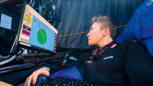
British sailor Will Harris has risen to the top of offshore racing. From winning the Class 40s in the 2021 Rolex Fastnet Race, he co-skippered the IMOCA Malizia with Boris Herrmann in the 2023 Ocean Race, finishing 3rd. Photo: Felix Diemer/Musto
The data gave us the confidence to make a move that for some would have been counterintuitive. With everything you do with your race planning, you’re looking to paint yourself a picture of what the race is going to be like so that nothing comes as a surprise.
So when a front is approaching and the wind is going to change, you already know what sail combination you’re going to use, you already know what preparations you need to make, whether it’s to put on lifejackets or take in a reef. Analysing the weather models can be a lot of work, but when it gives you the winning edge it’s time well spent.
 If you enjoyed this….
Yachting World is the world’s leading magazine for bluewater cruisers and offshore sailors. Every month we have inspirational adventures and practical features to help you realise your sailing dreams.Build your knowledge with a subscription delivered to your door. See our latest offers and save at least 30% off the cover price.
Note: We may earn a commission when you buy through links on our site, at no extra cost to you. This doesn’t affect our editorial independence.
The post Expert Navigator Tips: How to Master Weather Models for a Winning Edge appeared first on Yachting World.